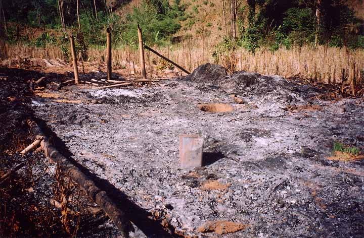
 1-33
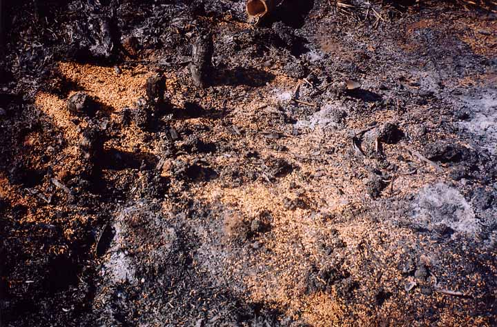 1-34
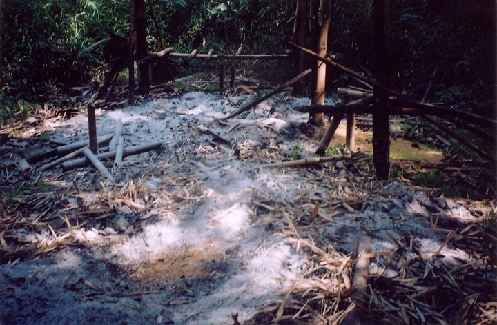 1-35
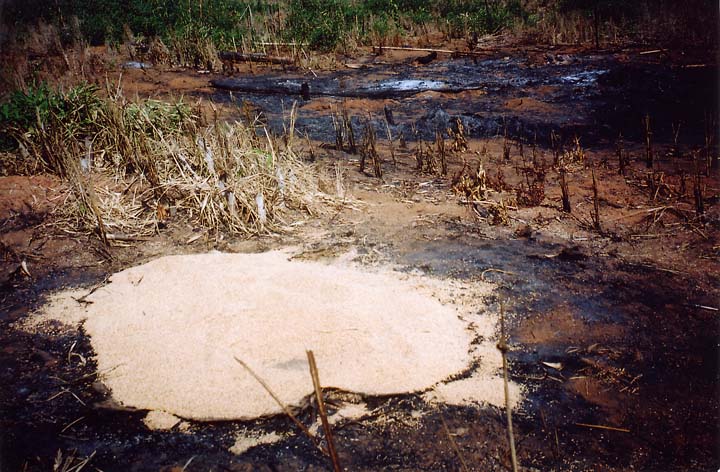 1-36
1-33
1-34
1-35
1-36
 1-37
 1-38
 1-39
 1-40
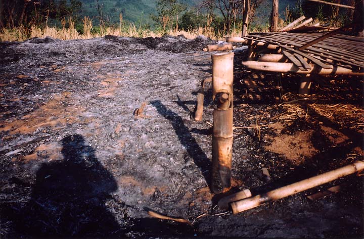
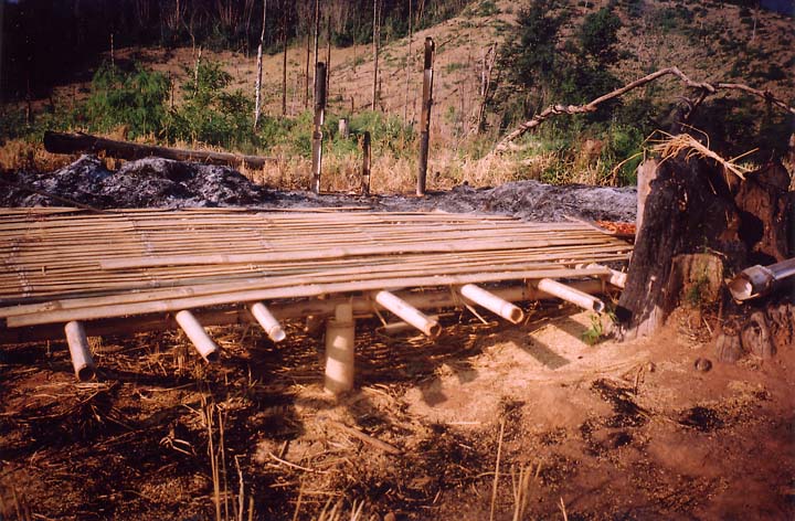
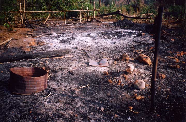
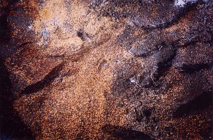
Photos #1-33, 1-34, 1-35, 1-36, 1-37, 1-38, 1-39, 1-40: SPDC columns appear to have deliberately timed their attack on hill villages in Shwegyin Township in November/December 2004 (see Section 1, A Short Story in Pictures) to interfere with the rice harvest, because they not only burned villages but systematically sought out and destroyed paddy storage barns hidden in the forest and farmfield huts with their piles of harvested paddy, then stayed around the villages to prevent villagers from returning to complete their harvest. Photo 1-33 shows the farmfield hut of Pa T--- from Khaw Hta, burned along with the paddy (photo 1-34) he had already harvested. The remains of B---’s paddy storage barn, with his paddy still smouldering, are shown in photo 1-35, while photo 1-36 shows the burned patch of ground where his farmfield hut used to be; in the foreground he has piled the only paddy he could salvage from the ashes. Both were burned by a combined column of LIB 587, LIB 589 and IB 57. Saw P--- lost 70 baskets of newly harvested paddy and all of his farming implements when LIB 350 burned his field hut (photos 1-37 and 1-38). The burned ground in photo 1-39 used to be the farmfield hut of a Yah Aw villager. Photo 1-40 provides a closeup view of Pa D---’s partial paddy harvest, now little more than a mound of charred and blackened grains. All of these photos were taken between 6 and 15 December 2004. (Photo and Text Source: KHRG, 2004)
~ ~ ~ ~ ~ ~ ~ ~ ~ ~ ~ ~ ~ ~
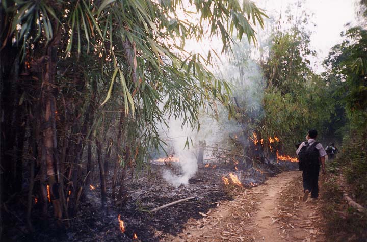 7-5
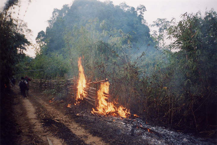 7-6
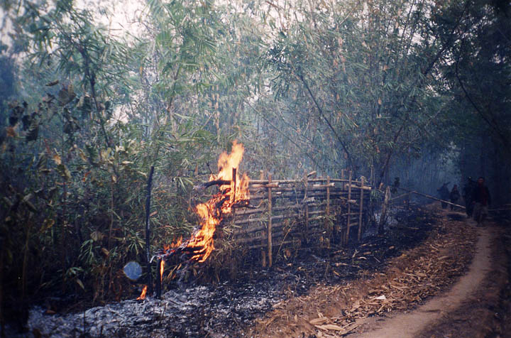 7-7
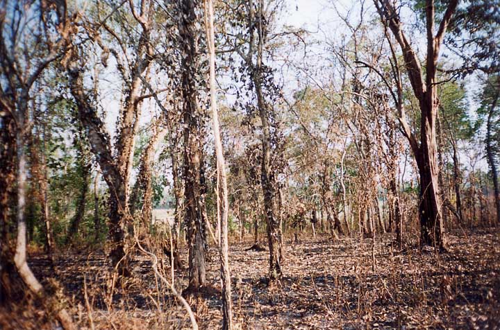 7-8
Photos #7-5, 7-6, 7-7, 7-8: On 22 March 2004, soldiers from SPDC IB 283 entered Htee Meh Baw village in Kawkareik Township, Dooplaya District to demand food from the villagers. Upon returning to their camp, they set fire to the bush along the roadside. In the process, they also set fire to all the villagers’ banana, betelnut, and peppercorn plantations and hill fields lining the road. Photo 7-8 shows one of the peppercorn plantations that was destroyed. (Photo and Text Source: KHRG, 2004)
~ ~ ~ ~ ~ ~ ~ ~ ~ ~ ~ ~ ~ ~
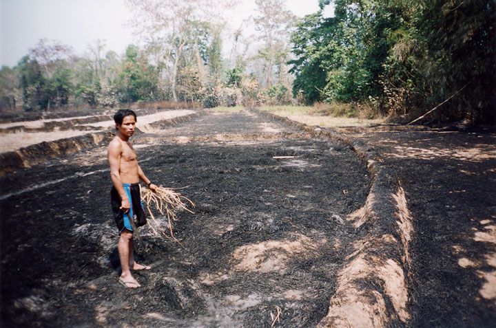 7-9
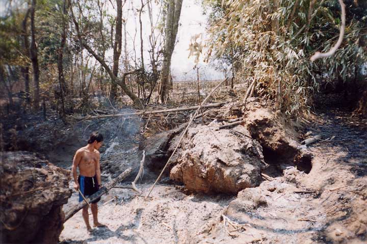 7-10
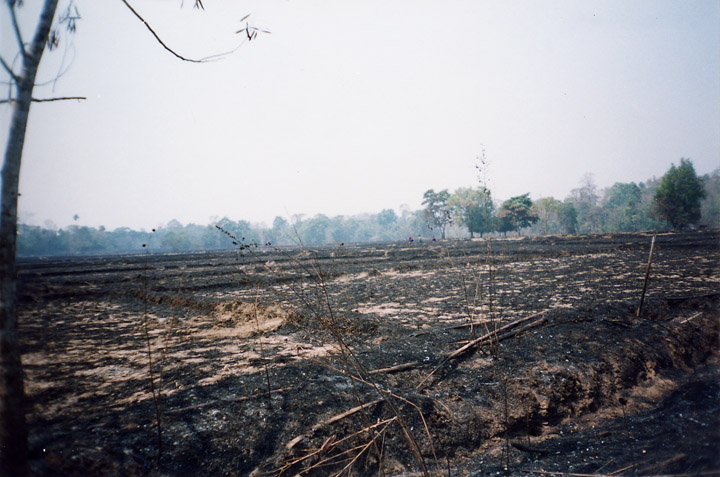 7-11
Photos #7-9, 7-10, 7-11: On 4 March 2004, LIB 549 troops (Battalion Commander Thu Ra Myo Tint commanding) burned a ‘killing zone’ along the flanks of the Kyaikdon to Lay Po Hta car road in Dooplaya District to protect Maung Maung Sein, the visiting commander of Military Operations Command 12, from ambush as he travelled along the road. The fire quickly raged out of control and destroyed many fields and plantations in the area. These photos taken the next day show Pa K--- from P--- village standing in his burned field (photo 7-9) and inspecting his destroyed irrigation works (photo 7-10). Photo #7-11 shows the extent of the burned irrigated-paddy fields. The people of several villages were affected by the fires, but no compensation was paid to the villagers for their loss. (Photo and Text Source: KHRG, 2004)
~ ~ ~ ~ ~ ~ ~ ~ ~ ~ ~ ~ ~ ~
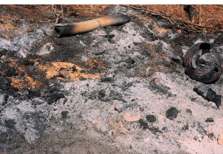
7-17
Photo #7-17: This pile of ash and charred paddy is all that remains of a rice storage barn near the IDP hiding site at K--- in Lu Thaw Township, Papun District. Soldiers from SPDC LID 55 burned it on 30 December 2003 as their forces swept through the area in search of IDPs and their food supplies. This photo was taken in January 2004. (Photo and Text Source: KHRG, 2004)
~ ~ ~ ~ ~ ~ ~ ~ ~ ~ ~ ~ ~ ~
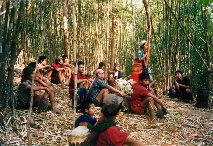
10-24
Photo #10-24: These villagers from B--- village, Bu Tho Township, Papun District left their village after SPDC troops set up a camp along the vehicle road nearby in April 2004. With the camp on the road, they said that they could no longer dare travel to town to get food or work farmfields anywhere near the road. (Photo and Text Source: KHRG, 2004)
~ ~ ~ ~ ~ ~ ~ ~ ~ ~ ~ ~ ~ ~