|
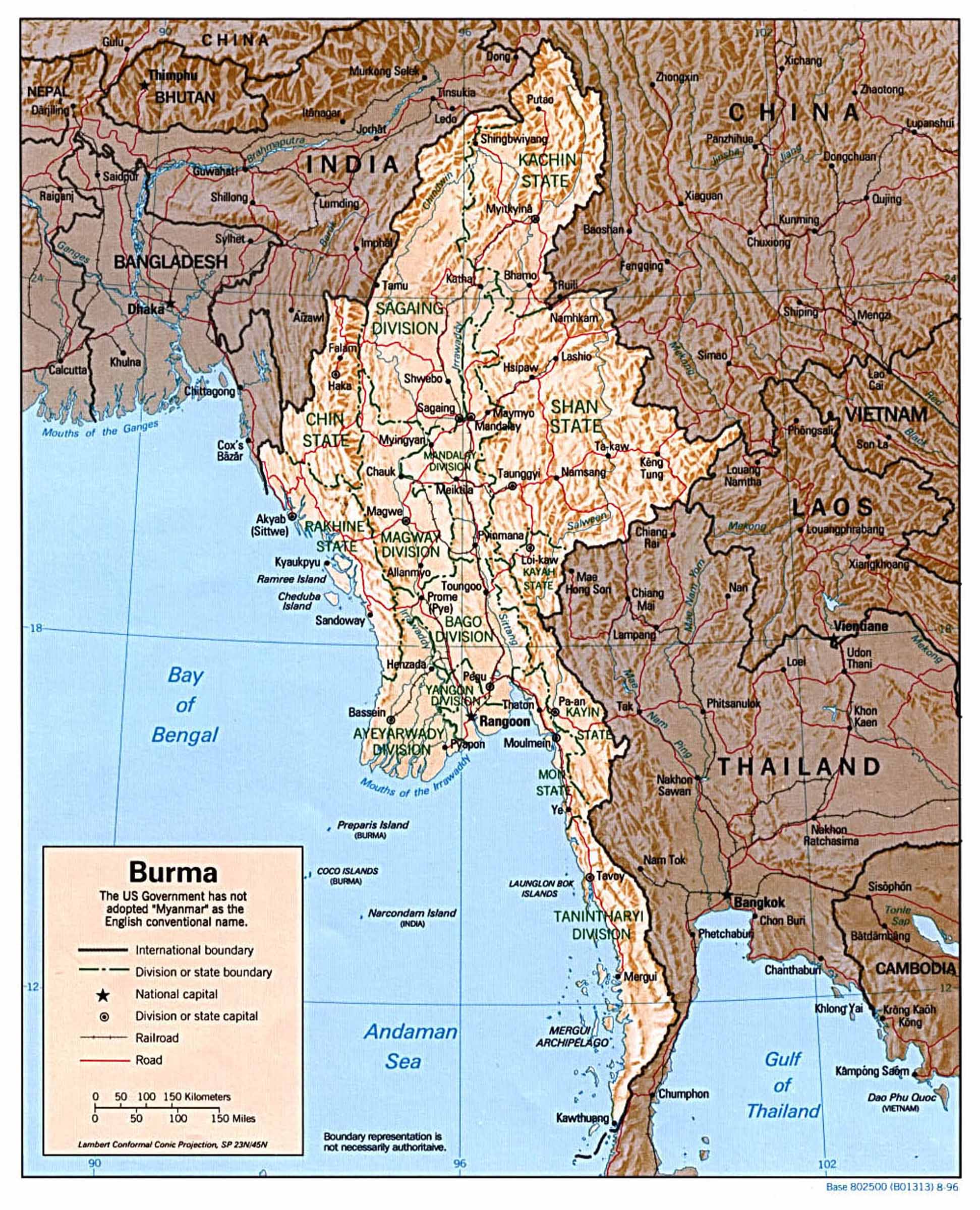
Political Map of Burma © CIA World Factbook |
|
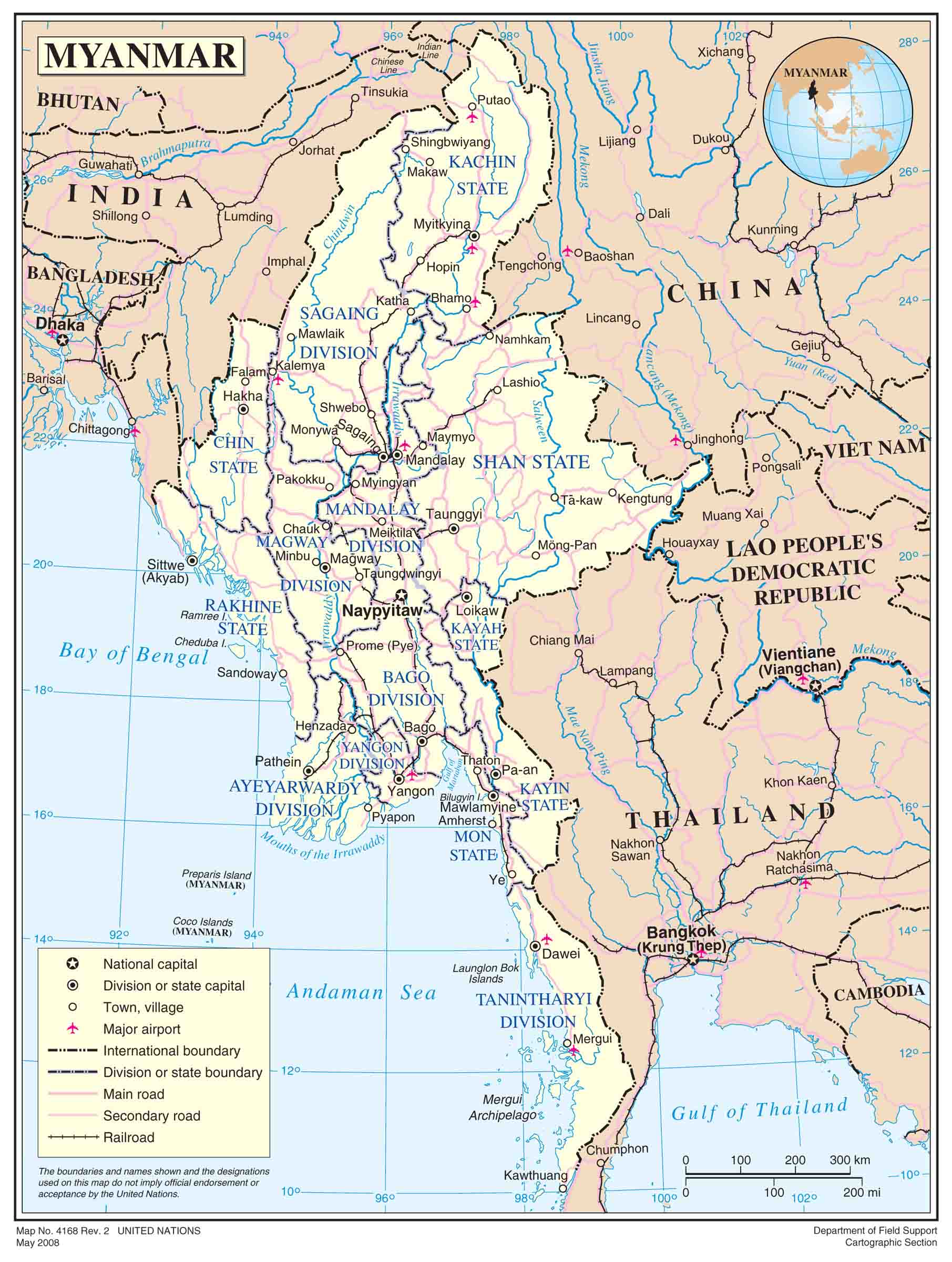
Political Map of Burma © United Nations |
|
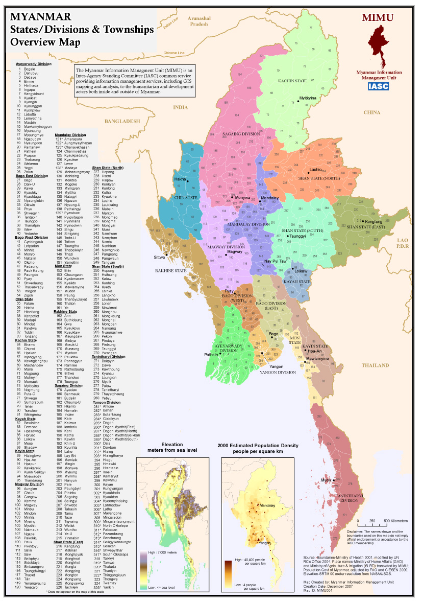
States/Divisions and
Townships of Burma © Myanmar Information Management Unit |
|
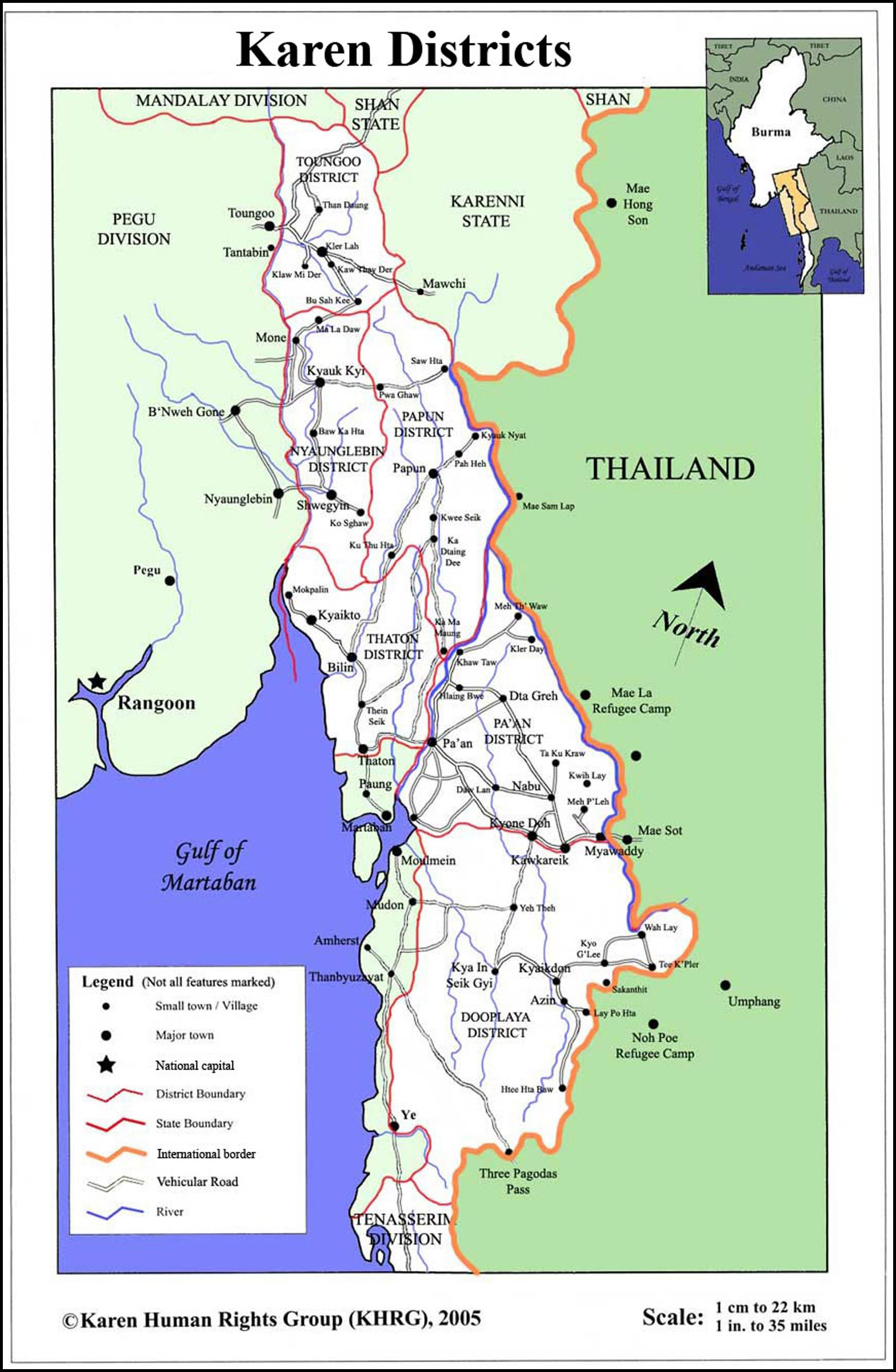
Districts of Karen State © Karen Human Rights Group |
|
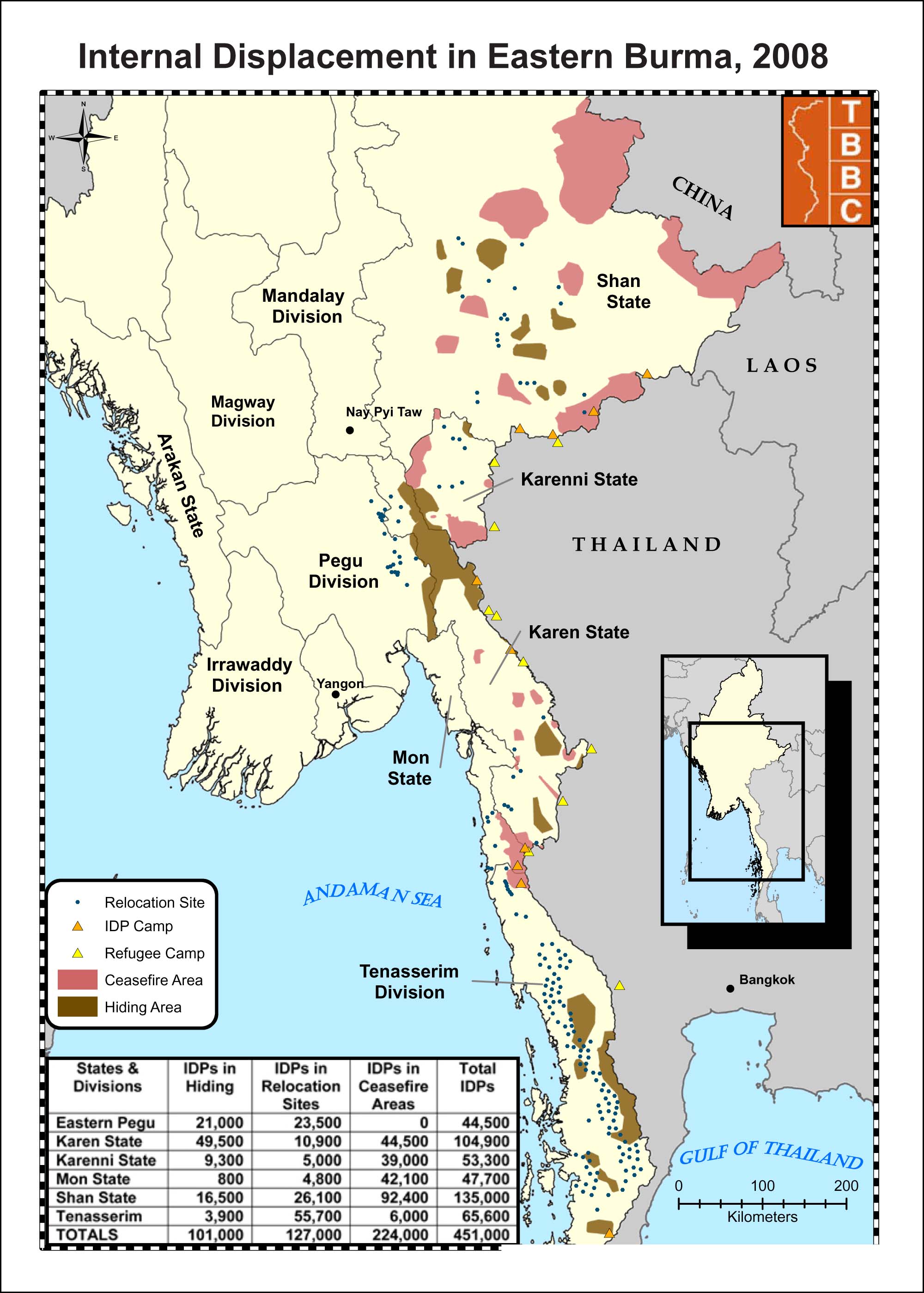
Internally Displaced Persons
in Eastern Burma, 2008
© Thailand Burma Border Consortium |
|
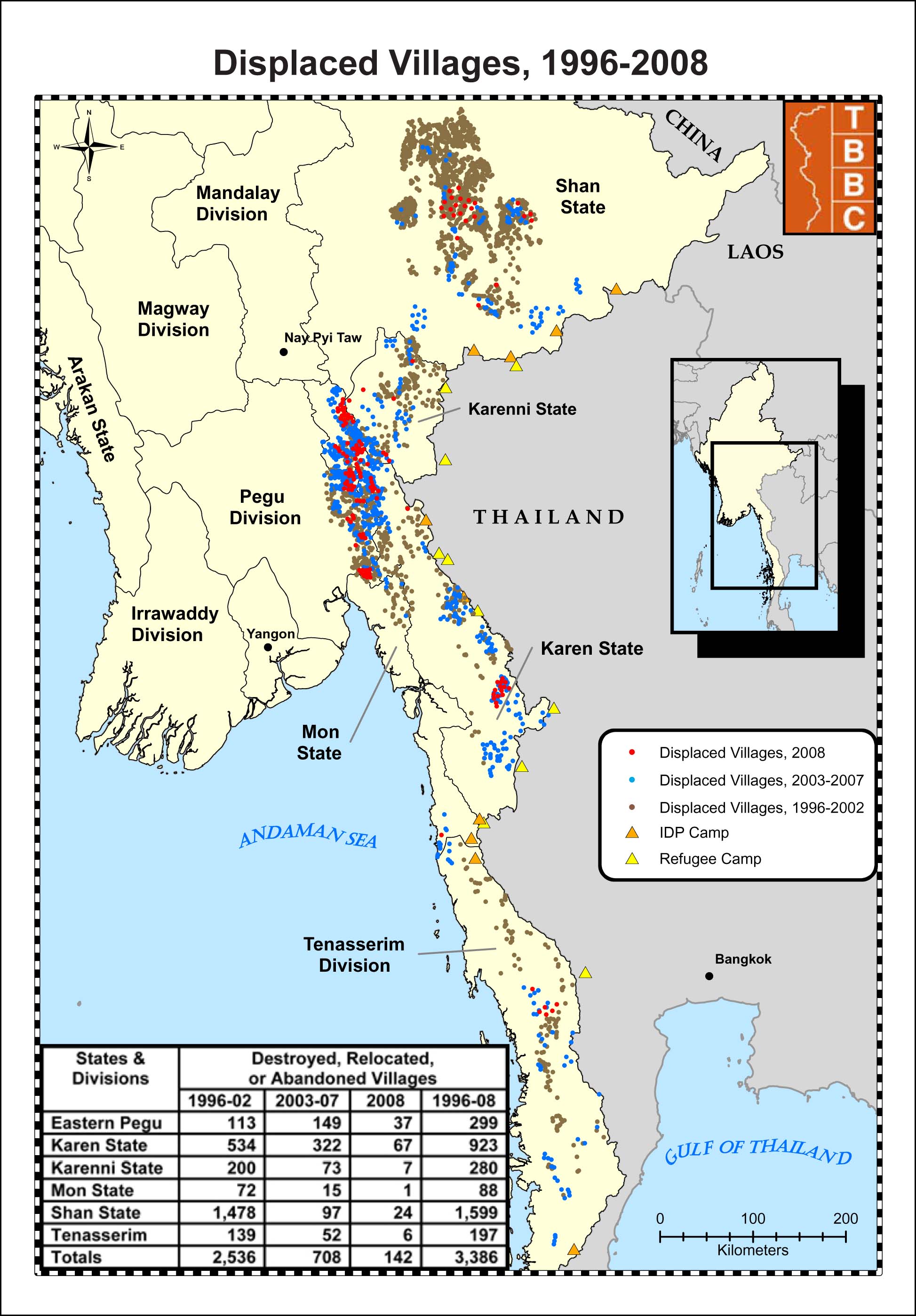
Displaced Villages in Eastern Burma, 1996-2008 © Thailand Burma Border Consortium |
|
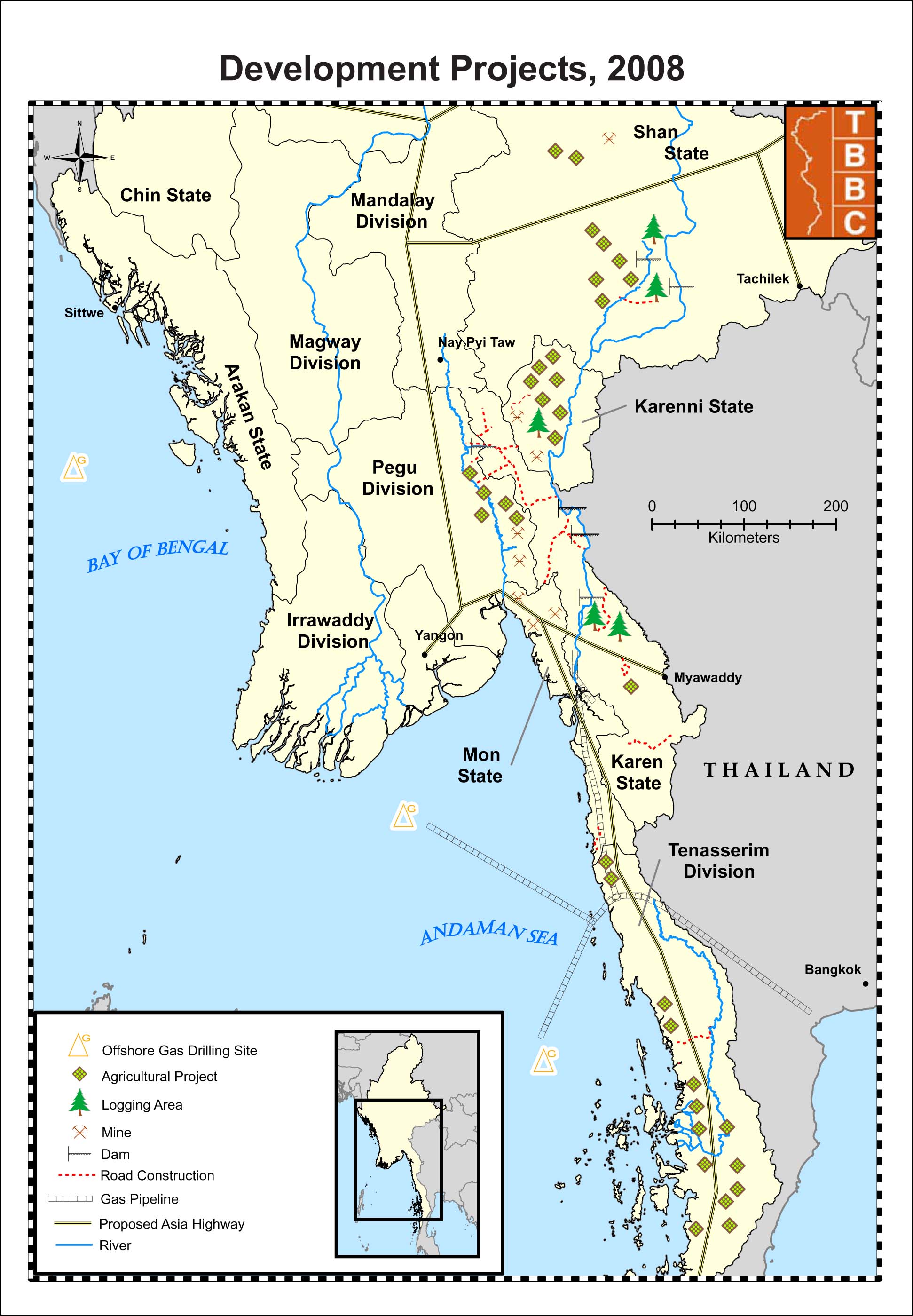
Development Projects Related to
Human Rights Abuses, 2008 © Thailand Burma Border Consortium |
|
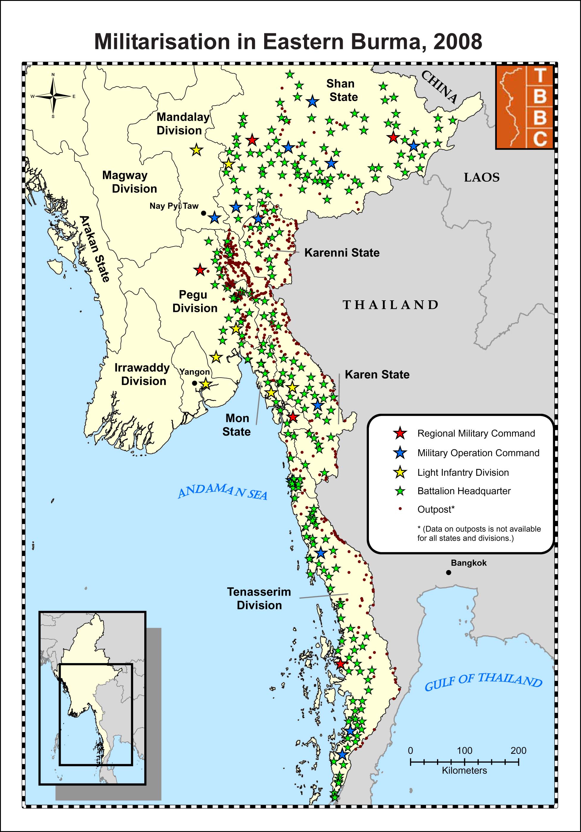
Militarization in
Eastern
Burma, 2008 © Thailand Burma Border Consortium |
|
Burmese Refugee Camp Locations © Europa Technoogies Ltd. |
|
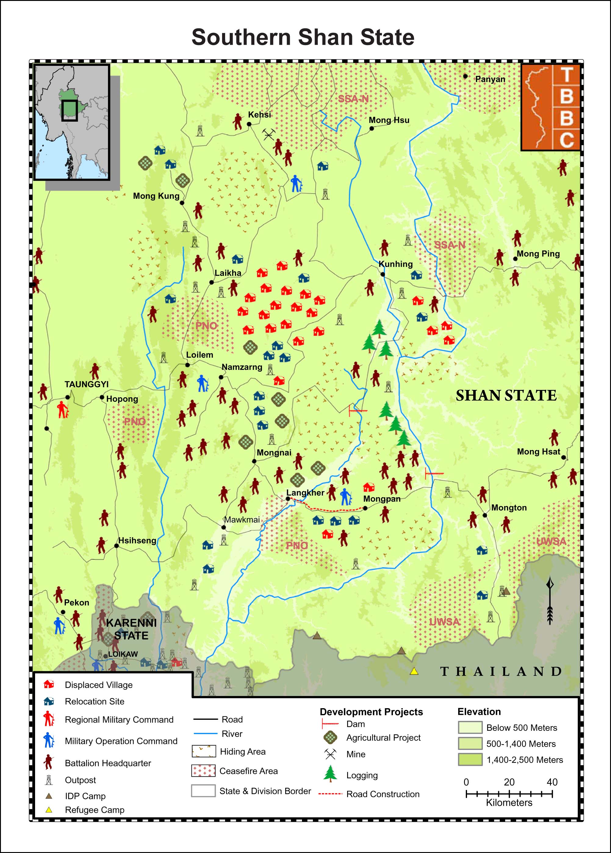
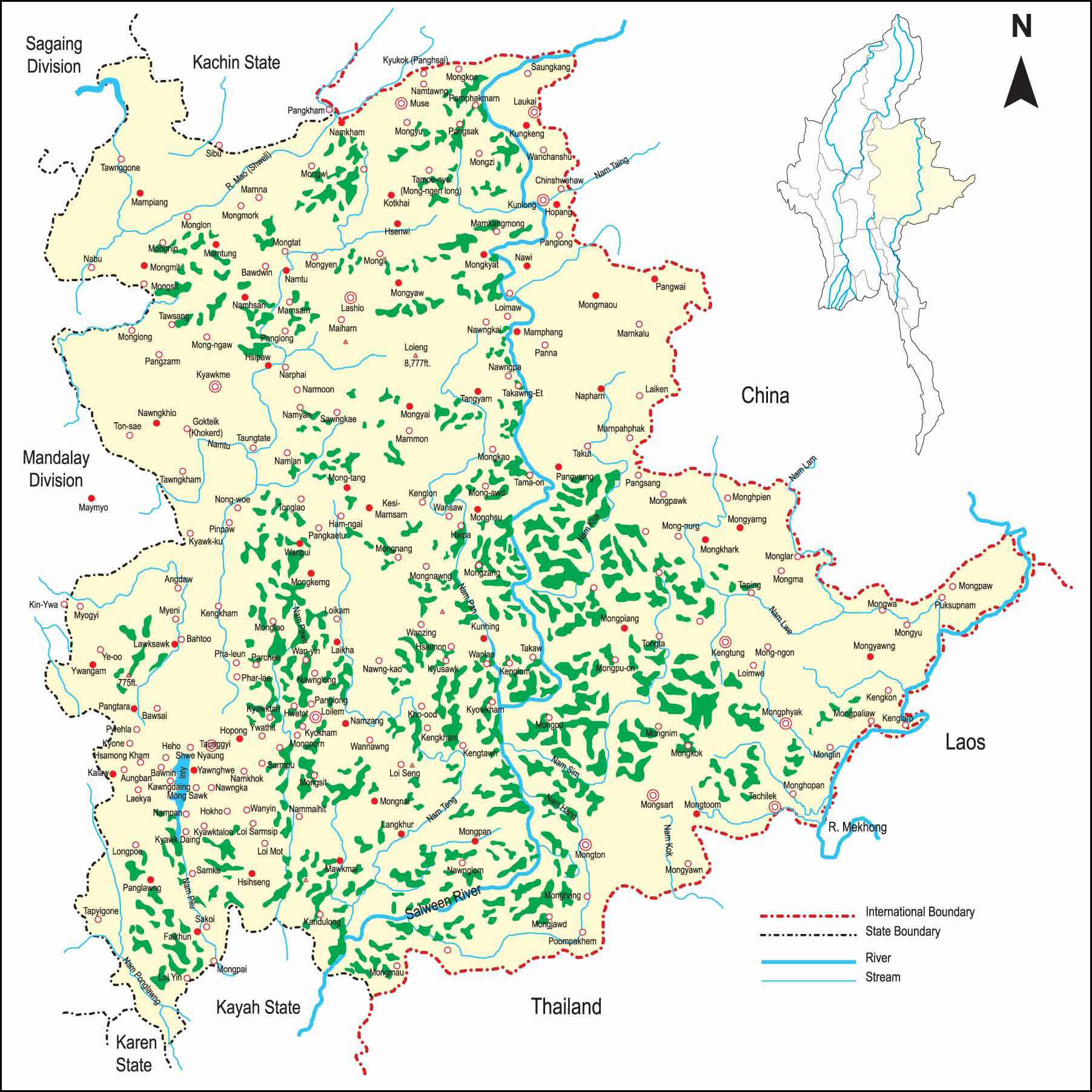
Southern Shan State, 2008 © Thailand Burma Border Consortium |
|
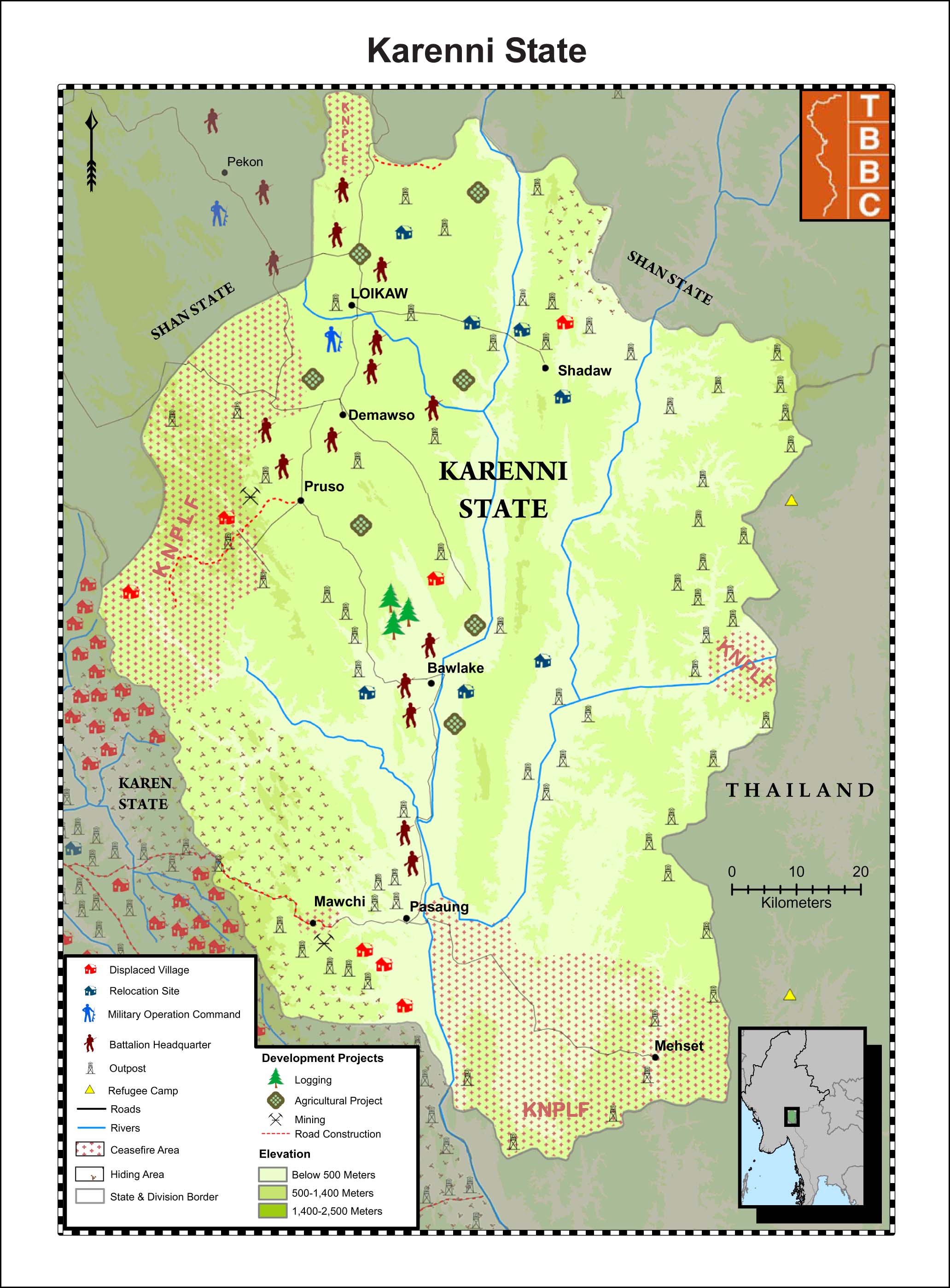
Karenni State, 2008 © Thailand Burma Border Consortium |
|
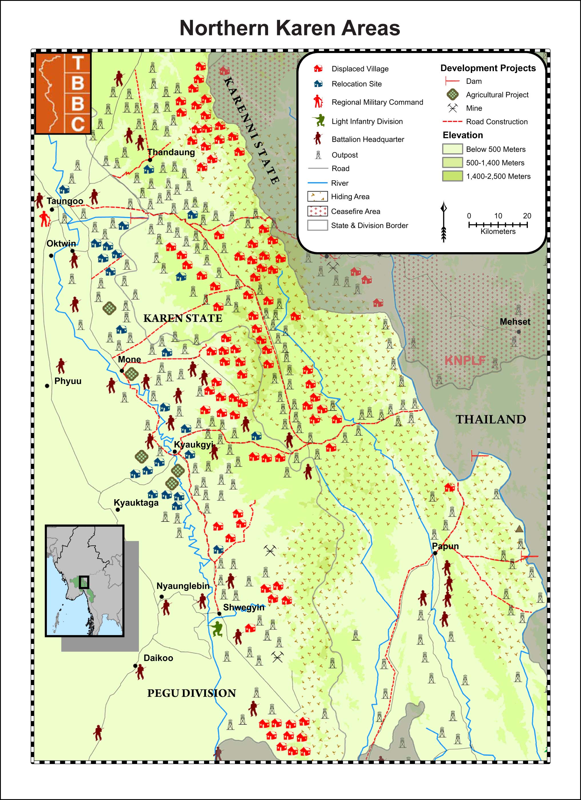
Northern Karen State, 2008 © Thailand Burma Border Consortium |
|
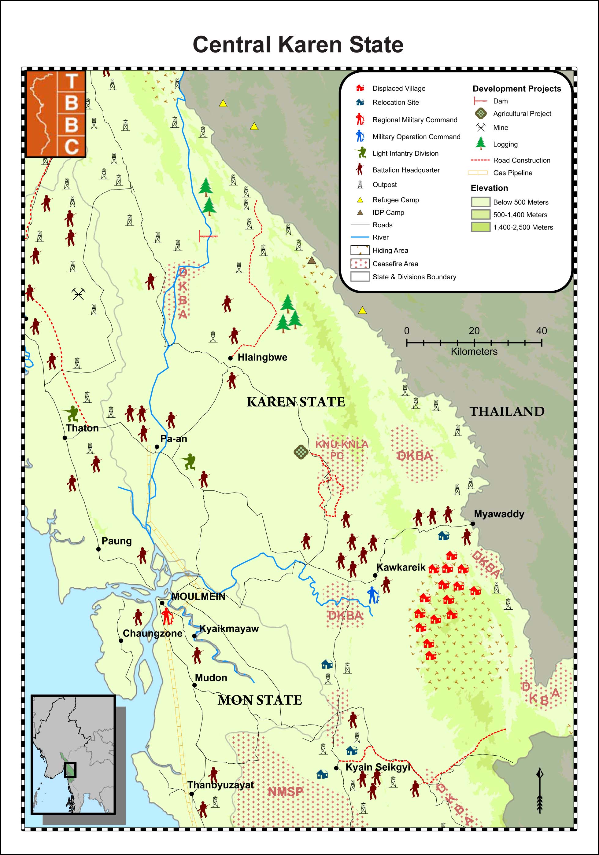
Central Karen State, 2008
© Thailand Burma Border Consortium |
|
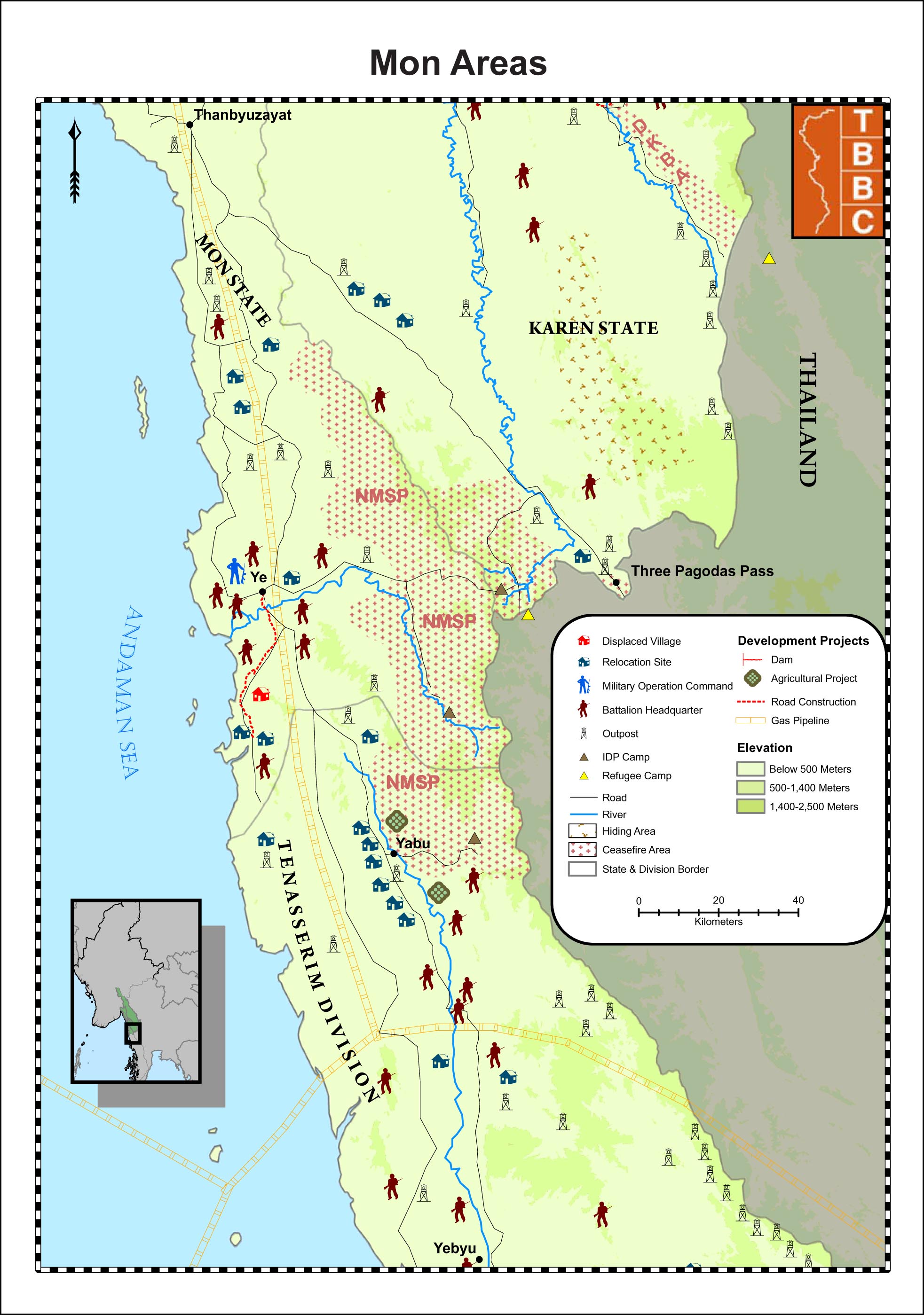
Mon State, 2008 © Thailand Burma Border Consortium |
|
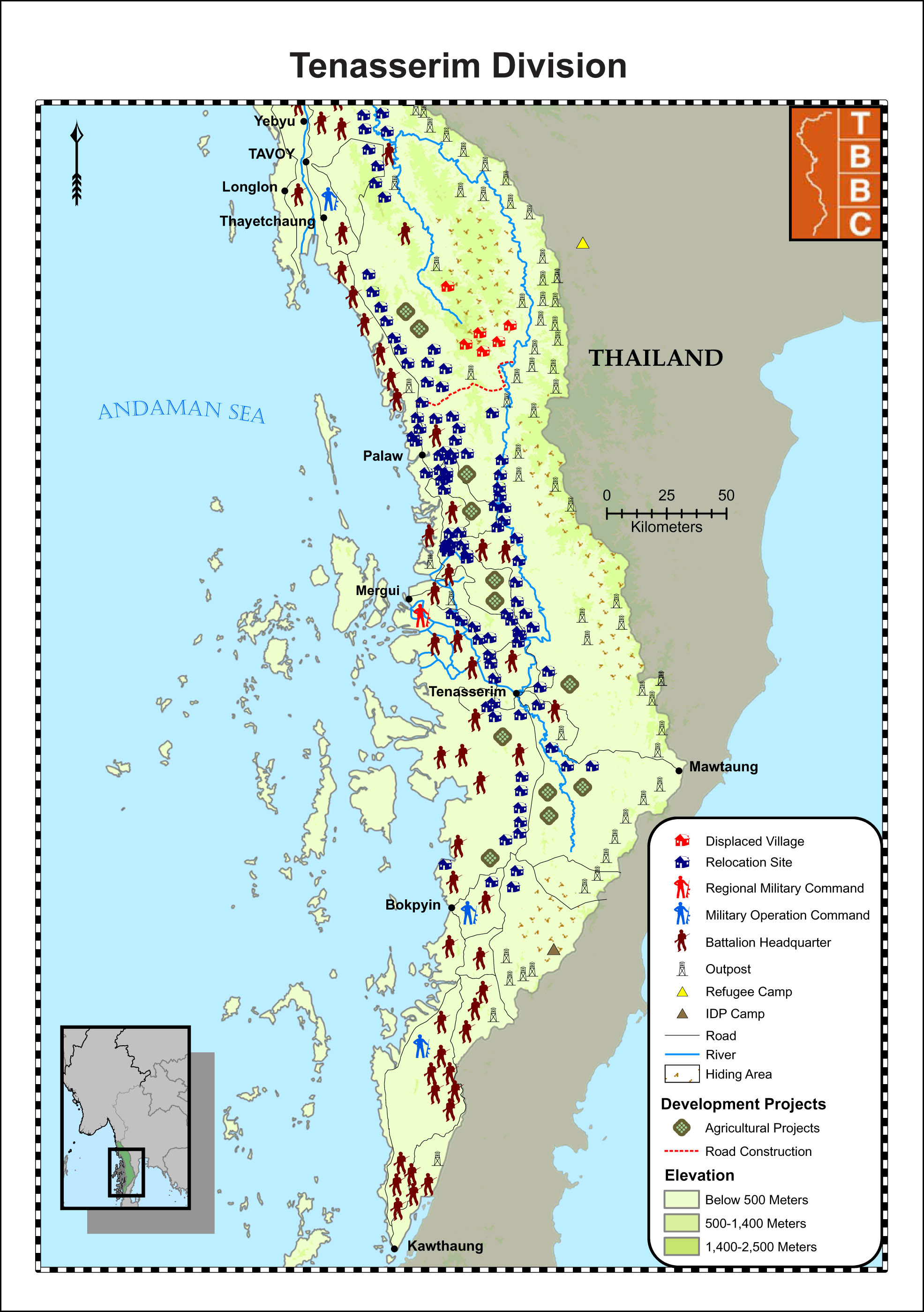
Tenasserim Division, 2008
© Thailand Burma Border Consortium |
|
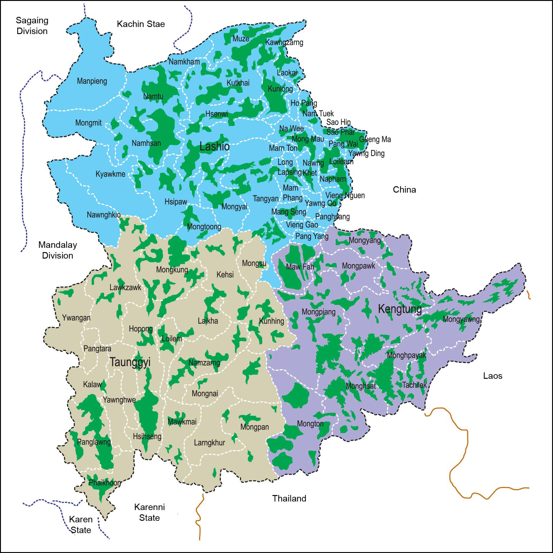
Opium Cultivation in
Shan State, 2008-2009 © Shan Herald Agency for News |
|
Opium Cultivation in
Shan State, 2002-2003© Shan Herald Agency for News |
|
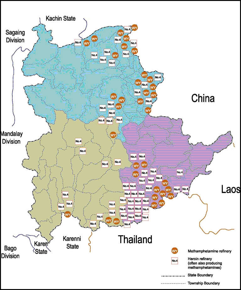
Known Drug Refineries in
Shan State, 2008 © Shan Herald Agency for News |
|
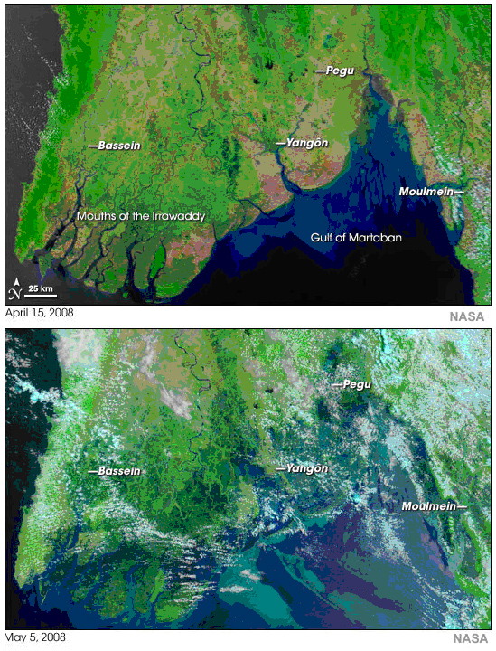
Irrawaddy Division
Before and After Cyclone Nargis
© NASA/MODIS Rapid Response Team |
|
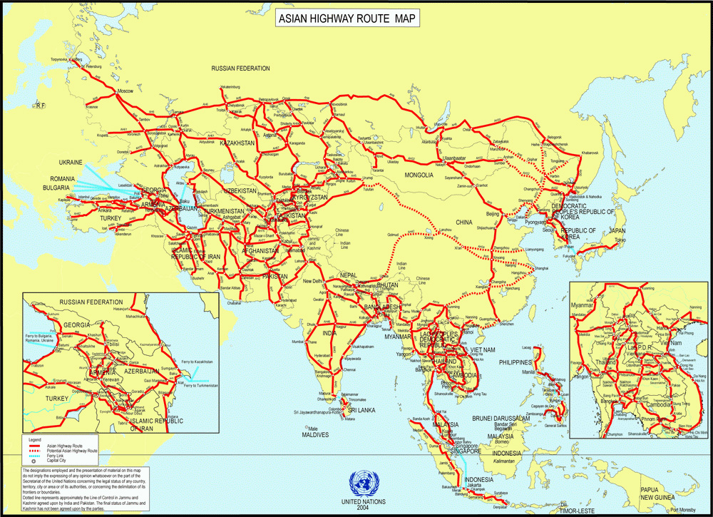
Proposed Route of the
Asian Highway © United Nations |
|
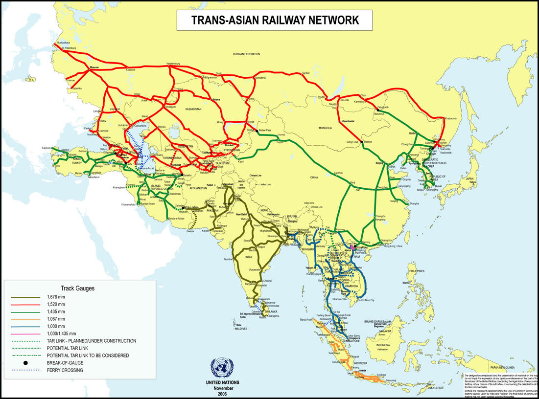
Proposed Route of the
Trans-Asian Railway© United Nations |
 Map Room